Do the Central Planners Give a Damn?
I have a cottage at Minaki, Ontario, which is down the Winnipeg River from the Lake of the Woods. Under a treaty between Canada and the United States, the Lake of the Woods can’t go above a certain level. The reason is that part of the Lake of the Woods is in Canada and part is in the United States. So when it gets close to that level, the government opens the dam at the north end of the lake to let the water flow downstream. We downstream people, therefore, are at the mercy of the authorities who open the dam.
What would be a reasonable way to both comply with the treaty and look out for the people downstream? It would be to see what’s happening with snowfall in the winter and, on that basis, predict what will happen to runoff. And then if the estimate is that the spring runoff will be high, start releasing early and not wait until May.
But here’s what they’re doing. One quote is precious:
Since April 20, water levels on Lake of the Woods have risen by roughly 25”, while levels on the Winnipeg River have risen by about 67” since early April. The rise in levels has been driven by the area breaking numerous precipitation and snowfall records throughout the winter. (emphasis added.)
On a site of Minaki residents and cottage goers that I follow on Facebook, a year-round Minaki resident put it well:
Yup you could not have had a clue what was going to happen with all the snow last winter, could you? Let’s guess at a dry spring and hold all the water back because the lake is too low. Trust the science. We are in Ottawa and know what’s going on.
Well said.
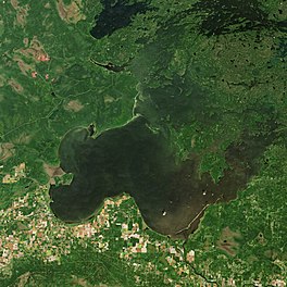
The picture above is of the Lake of the Woods, which is partly in Manitoba and Ontario and partly in Minnesota.